The One-Armed Visionary Who Tried to Redraw America — and Almost Saved the West From Itself
The One-Armed Visionary Who Tried to Redraw America — and Almost Saved the West From Itself
Somewhere in the archives of the United States Geological Survey, there's a map that didn't make it. It shows the American West divided not into the rectangular states we know — Nevada, Utah, Colorado, Arizona — but into irregular, organic shapes that follow rivers, mountain ridges, and the natural contours of where water flows and where it doesn't. It looks strange at first glance, almost like someone got the borders badly wrong.
It wasn't a mistake. It was arguably the most honest map of the American West ever drawn. And the man who made it was told, in no uncertain terms, to sit down and stop talking.
The Man Behind the Map
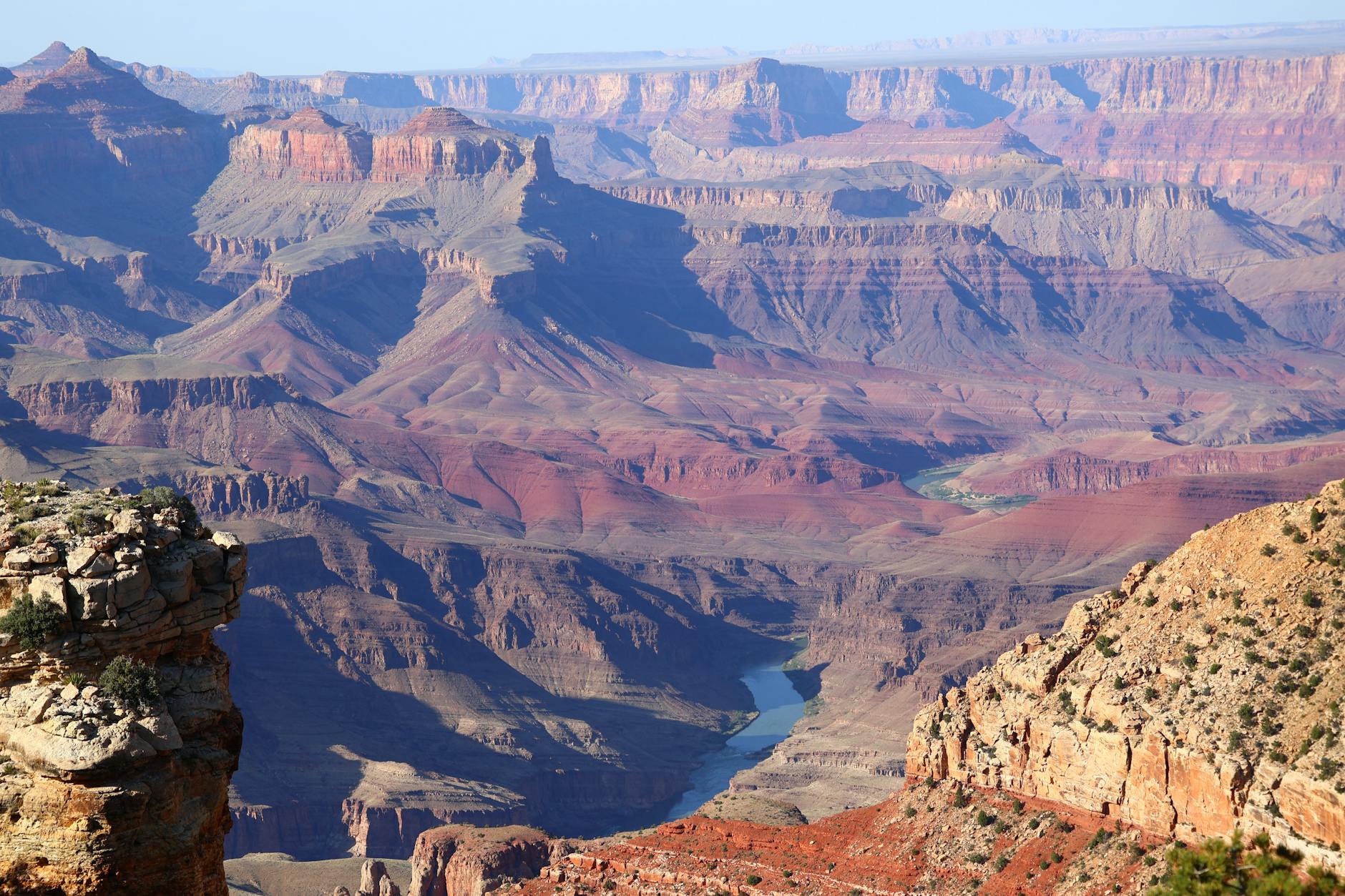
John Wesley Powell doesn't get nearly enough credit in mainstream American history, which is remarkable given what he actually did. In 1869, he led the first documented expedition through the Grand Canyon — by boat, down the Colorado River — with one arm. He'd lost the other at the Battle of Shiloh. The trip was extraordinarily dangerous, undertaken with a small crew on wooden boats through some of the most violent whitewater on the continent. Several members of the party abandoned the expedition partway through, convinced they would die. Powell kept going.
After the canyon, he spent years surveying the broader American West for the federal government, eventually becoming the second director of the U.S. Geological Survey. He was a careful, meticulous observer. And what he observed, over and over again, was that the West was fundamentally different from the East — and that the people planning its settlement hadn't figured that out yet.
The Radical Idea Nobody Wanted
The core of Powell's argument was simple and, in retrospect, almost painfully obvious: water in the American West is scarce, unevenly distributed, and the single most important factor determining whether any given area can support human settlement. Therefore, he argued, the boundaries of states and territories in the West should be drawn around watersheds — the natural drainage basins that determine where water comes from and where it goes — rather than the arbitrary straight lines that Congress was busy stamping across maps.
In his 1878 report, Report on the Lands of the Arid Region of the United States, Powell laid this out in detail. He proposed that Western communities should be organized around shared water systems, that irrigation rights should be tied to the land actually within a given watershed, and that the federal government should stop encouraging mass settlement in areas that simply couldn't support it.
The report was a direct challenge to the mythology of Manifest Destiny — the idea that American ingenuity and hard work could make any land bloom. Powell was saying: no, actually, some land cannot bloom, and pretending otherwise is going to cause serious problems.
Congress was not interested in hearing this.
The 1890 Showdown
Things came to a head in 1890 when Powell addressed Congress directly, arguing against a rapid expansion of irrigation projects in the West that he believed were being wildly oversold to settlers. Western land speculators and boosters had enormous political power, and Powell was threatening their business model. The backlash was swift. His funding was slashed. His survey was curtailed. He resigned from the Geological Survey in 1894, his watershed vision officially dead.
The straight lines stayed. The settlers kept coming. The irrigation projects got built — including, eventually, the Hoover Dam and the vast network of canals and diversions that turned the Colorado River into the most engineered waterway in the world.
What His Map Actually Looked Like
Powell's proposed watershed districts for the West were irregular polygons that traced the high ridges separating river systems. The Rio Grande basin was one unit. The Colorado River drainage was another. The Columbia River system carved out the Pacific Northwest. Within these zones, Powell envisioned locally governed water-sharing compacts — communities that understood they were in the same hydrological boat and would have to cooperate or fail together.
What this would have meant practically is that states like Nevada and Arizona would have been drawn much smaller, limited to the areas their available water could actually support. Large chunks of what became Las Vegas's metropolitan footprint, Phoenix's sprawl, and the Central Valley's agricultural empire simply wouldn't have been developed the way they were — because the governance structure would have made the water math visible from the start.
The Drought That Proved His Point
Fast forward to today. Lake Mead, the reservoir created by the Hoover Dam on the Colorado River, has hit record low levels multiple times in the past decade. The seven states that share the Colorado River have been in near-constant conflict over water allocations. Phoenix is paying residents to rip out their lawns. Farmers in California's Imperial Valley are being paid not to plant crops, just to free up water for cities downstream.
Climate scientists and urban planners who study Western water policy have been quietly revisiting Powell's ideas for years. The concept of watershed-based governance — managing land and water as a single system rather than carving it up along political lines — has made a genuine comeback in academic and policy circles. It goes by different names now: integrated water resource management, bioregional planning. But the underlying logic is the one Powell was arguing in 1890.
A Prophet With Bad Timing
Powell wasn't perfect. His views on Indigenous peoples were complicated, shaped by the assumptions of his era. And his vision of watershed governance would have required a level of federal coordination that was politically impossible then and might be nearly as difficult now.
But on the central question — can the American West support the civilization being built on top of it without a fundamentally different relationship to water — he was right. Demonstrably, measurably right. The evidence is currently visible from satellite imagery of a shrinking Lake Powell, which was named, with some irony, after the man who warned this was coming.
The map that didn't make it is still out there. And as the West gets drier, it's starting to look less like a radical idea and more like the answer to a question we probably should have asked a long time ago.