When Mapmakers' Mistakes Became Real Places: The Phantom Towns That Fooled America for Decades
The Town That Never Was
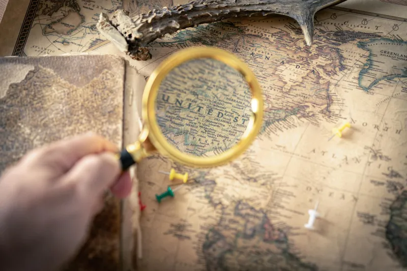
Somewhere in the archives of American cartography lies one of history's most persistent lies: a town that existed on paper for nearly a century but never housed a single resident. Born from a cartographer's tired eyes and a smudged ink blot, this phantom settlement appeared on map after map, copied faithfully by publishers who assumed their predecessors knew something they didn't.
This wasn't an isolated incident. Across 19th-century America, mapmakers routinely created fictional geography through simple human error—and these mistakes had surprisingly real consequences.
The Anatomy of Accidental Towns
Cartographic errors came in many flavors. Sometimes a surveyor's handwriting was so poor that "Mill Creek" became "Will Creek" on the final map. Other times, a publisher would misread coordinates and place a real town fifty miles from its actual location. The most common culprits were what archivists now call "trap streets"—deliberately fictional places that mapmakers inserted to catch copyright thieves.
But the most fascinating errors were completely accidental. A coffee stain might become a lake. A torn corner could erase a mountain range. And occasionally, a cartographer working by candlelight would simply invent a settlement where none existed, perhaps filling in what seemed like suspiciously empty space on the frontier.
When Fiction Shaped Reality
These paper towns weren't just amusing footnotes—they actively influenced American settlement patterns. Pioneers planning westward journeys would study maps and choose routes based on where they expected to find established communities. Some travelers spent days searching for phantom towns that existed only in their guidebooks.
In Kansas, one particularly persistent map error showed a thriving settlement called "Peckham" that appeared on official railroad maps for thirty years. Land speculators bought property near the supposed town site. The railroad even printed tickets to Peckham, though the conductor would have to explain to confused passengers that they'd reached their destination when the train stopped at an empty prairie.
The Persistence of Paper Geography
Once a mistake made it onto a major map, it became remarkably difficult to correct. Publishers copied from other publishers, creating an echo chamber of misinformation. Government surveyors, working with limited budgets and tight deadlines, often relied on existing commercial maps rather than conducting fresh surveys.
The result was a kind of geographical folklore. Some phantom towns appeared on maps published decades apart by completely different companies. A few even made it into early telephone directories and postal guides, creating an official paper trail for places that had never existed.
The Human Side of Exploration
These mapping mistakes reveal something profound about 19th-century America: the country was being documented faster than it was being explored. Cartographers were under enormous pressure to publish complete, authoritative maps of territories that remained largely unknown. Rather than leave blank spaces—which might suggest their maps were incomplete—many chose to make educated guesses or copy questionable information from other sources.
The errors also highlight the surprisingly collaborative nature of early American cartography. Maps weren't created by lone explorers sketching virgin territory. They were assembled by teams of publishers, engravers, and editors working in cramped city offices, synthesizing information from dozens of sources of varying reliability.
Ghost Towns in the Digital Age
Many phantom towns have finally been corrected in modern mapping systems, but some persist in unexpected places. Legal property descriptions still reference long-vanished landmarks. Historical societies occasionally receive visitors looking for towns that never existed. And a few phantom places have achieved a kind of immortality in local folklore, with residents spinning tales about the "lost settlement" that old-timers claim to remember.
The digital age has largely eliminated accidental phantom towns, but it's created new categories of mapping fiction. GPS errors can temporarily create nonexistent roads. Crowdsourced mapping platforms sometimes include pranks or mistakes that spread across multiple services.
The Beauty of Imperfect Knowledge
Perhaps the most remarkable thing about America's phantom towns isn't that they existed, but that they remind us how recently our geography was genuinely unknown. The authoritative map hanging in a 19th-century schoolroom was often just one tired cartographer's best guess, copied and recopied until it became accepted truth.
These mapping mistakes humanize the grand project of documenting America. They remind us that the country we think we know was assembled piece by piece, often by people working with incomplete information and impossible deadlines. Every confident line on those old maps represented someone's leap of faith.
In our age of satellite imagery and GPS precision, there's something almost charming about a time when a simple spelling error could accidentally invent a town. These phantom places serve as monuments to the beautifully imperfect process of making the unknown world known—one mistake at a time.